
US News
Tropical Storm Arthur forms, bringing flood threat to Southeast
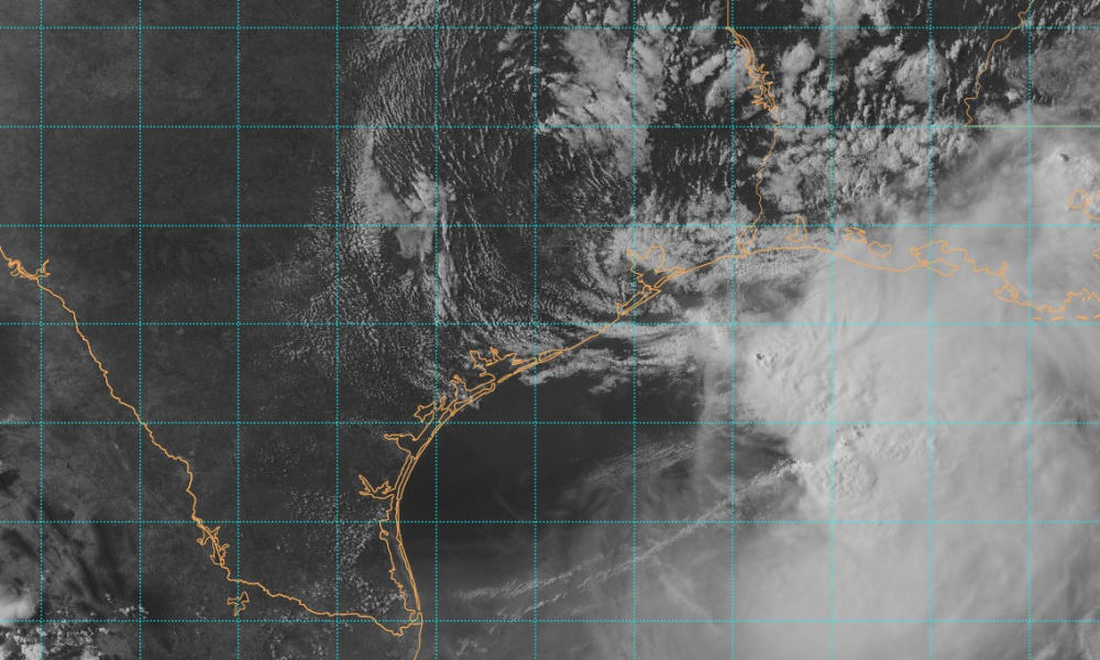
Tropical Storm Arthur, the first named storm of the Atlantic hurricane season, has formed near the Texas coast and is expected to bring life-threatening flooding across parts of the southeastern United States, according to the National Hurricane Center (NHC).
Arthur was located about 20 miles north-northwest of Matagorda, Texas, at 4 p.m. CDT, with maximum sustained winds of 45 mph. It was moving north-northeast at 7 mph.
A tropical storm warning is in effect from Sargent, Texas, to Morgan City, Louisiana, where tropical storm conditions are expected during the next few hours.
The NHC said Arthur’s center should move farther inland over southeastern Texas tonight. Weakening is expected as the storm moves inland, and it could dissipate by tonight or early Thursday.
Tropical-storm-force winds extend up to 175 miles from the center. A NOAA buoy east of Galveston recently reported sustained winds of 40 mph and a gust of 52 mph, according to the NHC.
Forecasters said rainfall remains the main threat. Arthur is expected to produce 5 to 10 inches of rain, with isolated totals near 20 inches, through early Friday from the mid and upper Texas coast into southern and central Louisiana, Mississippi and Alabama, as well as western Georgia and the Florida Panhandle.
The rainfall could cause dangerous to life-threatening flash flooding, the NHC said.
A storm surge of 1 to 3 feet is possible from Matagorda, Texas, to the mouth of the Mississippi River in Louisiana. Swells from Arthur are also expected to cause life-threatening surf and rip current conditions along the northwestern Gulf Coast for the next day or two.
A few tornadoes are possible late tonight across southeastern Louisiana and southern Mississippi, and on Thursday in parts of Alabama, Georgia and the Florida Panhandle.


Illinois man charged with threatening to attack Fort Bliss personnel and families

San Diego deputy sentenced for shove that fractured detainee’s spine

Sinaloa Cartel lieutenant charged with narcoterrorism in U.S. fentanyl case

Added floors likely caused instability at Midtown Manhattan tower – WSJ
-

 Legal3 days ago
6 shot, 1 killed, at San Antonio apartment complex
-

 World1 week ago
14 killed in Saudi oil company helicopter crash
-

 US News1 week ago
Texas deputy killed by truck at drunk-driving crash scene
-

 World1 week ago
Poland breaks its national heat record amid European heatwave
-

 Politics1 day ago
U.S. condemns China’s submarine ICBM test into Pacific
-

 Legal6 days ago
7 sentenced in Texas detention center attack that wounded officer
-

 World6 days ago
10 Buddhist monks killed when 11-year-old crashes pickup truck in Thailand
-

 Legal2 days ago
Police sergeant, mother and daughter killed in Ohio shooting; suspect dead