
World
Hurricane Genevieve becomes first Category 5 storm in eastern Pacific since 2024

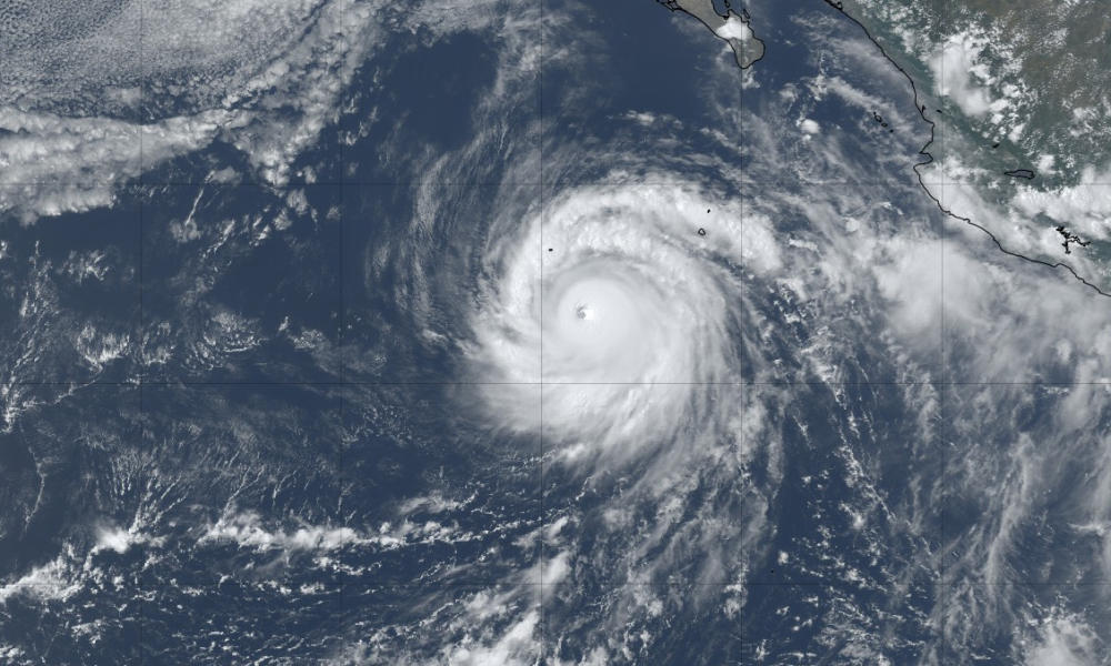
Hurricane Genevieve became the first Category 5 hurricane in the eastern Pacific since Kristy in 2024, reaching maximum sustained winds of 160 miles per hour before weakening later in the day.
The National Hurricane Center (NHC) upgraded Genevieve at 2 a.m. MST on Monday after satellite images showed a clear, well-defined eye surrounded by expanding cold cloud tops. Multiple satellite estimates indicated winds of between 158 and 163 mph.
Genevieve’s winds were estimated at 160 mph, making it a Category 5 hurricane on the Saffir-Simpson Hurricane Wind Scale, the highest classification. It was the first storm to reach that strength in the basin in nearly two years.
By 8 p.m. MST, Genevieve had weakened to a Category 4 hurricane with winds of 145 mph. Its eye had become more cloud-filled and thunderstorms were warming and thinning along part of the eyewall.
Forecasters said an eyewall replacement cycle may be starting, which could cause additional fluctuations in strength over the next day or so. Genevieve is moving northwest at about 12 mph.
The hurricane is expected to steadily weaken as it encounters drier air and cooler waters, with faster weakening forecast later this week. It is expected to become a post-tropical cyclone by the weekend.
Genevieve is the seventh named storm of the 2026 eastern Pacific hurricane season, which runs from May 15 through November 30.


Mitch McConnell remains in rehab, not medically cleared to return to Senate

Hurricane Genevieve becomes first Category 5 storm in eastern Pacific since 2024

Deaths of Michigan couple, 6 children ruled murder-suicide

SWISS flight with 208 on board diverts to Maine after reported cockpit fire
-
 Legal1 day ago
Couple identified after family of 8 found dead in suspected Michigan murder-suicide
-
 World2 days ago
NATO intern arrested in Belgium over suspected espionage
-

 World5 days ago
Houthis claim missile and drone attacks on 2 Saudi oil tankers in Red Sea
-

 Politics4 days ago
U.S. sanctions new CJNG leader, more than 50 people and companies
-

 US News6 days ago
All 4 U.S. soldiers killed in Jordan and Iraq identified
-

 World6 days ago
Death toll from Guyana ferry disaster rises to 53
-

 Legal5 days ago
2 Indianapolis police officers shot during disturbance call
-

 Legal5 days ago
Puerto Rico man charged over threats to bomb White House, attack soldiers and Jewish people