
World
Magnitude 6.3 earthquake strikes southern Sumatra, Indonesia
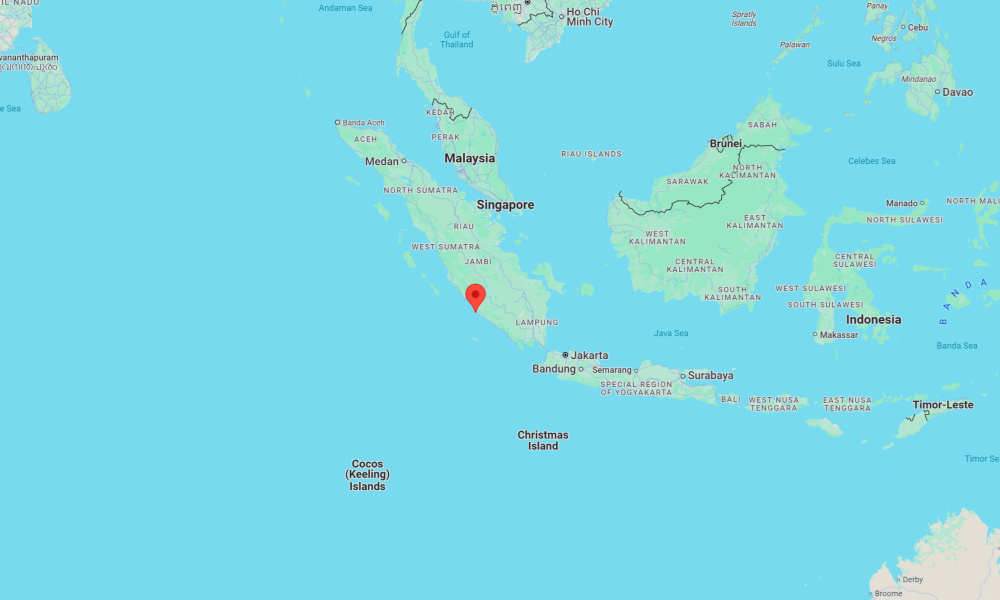
A preliminary magnitude 6.3 earthquake has struck southern Sumatra in Indonesia, according to seismologists.
The earthquake occurred at 2:52 a.m. local time on Friday and was centered near the coast of southern Sumatra, according to preliminary data from Indonesia’s Meteorology, Climatology, and Geophysical Agency (BMKG). It struck at a depth of 24 kilometers (15 miles).
The epicenter was located approximately 42 kilometers (26 miles) from Bengkulu and about 312 kilometers (194 miles) from Palembang.
Moderate shaking may have been felt near the epicenter, including in Bengkulu, a coastal city with a population of more than 300,000 people.
“It was so loud, it woke me up,” read one user-submitted report to BMKG. Other reports similarly described being woken by the strong shaking.
Indonesia is part of the commonly denominated Pacific Ring of Fire, a seismically active region that encircles much of the Pacific Ocean. While the Ring of Fire is known for frequent earthquakes and volcanic eruptions, it is not a single, unified system. The seismic events that occur along its various segments are typically caused by local tectonic processes and are not directly connected, even if they occur close in time.
In 2004, a massive undersea earthquake off the coast of northern Sumatra triggered one of the deadliest tsunamis in recorded history. The magnitude 9.1 quake struck on December 26 and generated waves as high as 30 meters (100 feet), devastating coastal communities across the Indian Ocean. More than 230,000 people were killed in 14 countries, with Indonesia suffering the highest number of casualties.


10 hostages rescued, suspect neutralized at Chase Bank in Bakersfield

U.S. military strikes another alleged drug vessel in Eastern Pacific

Indian man killed, 63 injured in Iranian drone attack at Kuwait airport

Mississippi deputy shot during standoff in Simpson County
-

 World4 days ago
Dutch police review arrest after pregnant woman thrown to ground in viral video
-

 World6 days ago
2 injured after Russian drone hits apartment building in Romania
-

 World3 days ago
U.S. citizen killed in shootout near Cabo tourist area in Mexico
-

 US News4 days ago
3 Latvian climbers killed in fall on Denali in Alaska; others injured
-

 Legal3 days ago
2 officers, police K-9 injured in Virginia shooting
-

 US News1 week ago
11 presumed dead after chemical tank blast at Washington plant, river contaminated
-
 US News3 days ago
United flight turns around over Atlantic after Bluetooth device named BOMB
-

 Legal1 week ago
Shopper killed, teen employee injured in grocery store shooting near Kansas City